Link to all categories of NM water data: NM Current Water Data
Link to all NM Stream Flow gages: NM Stream Flow
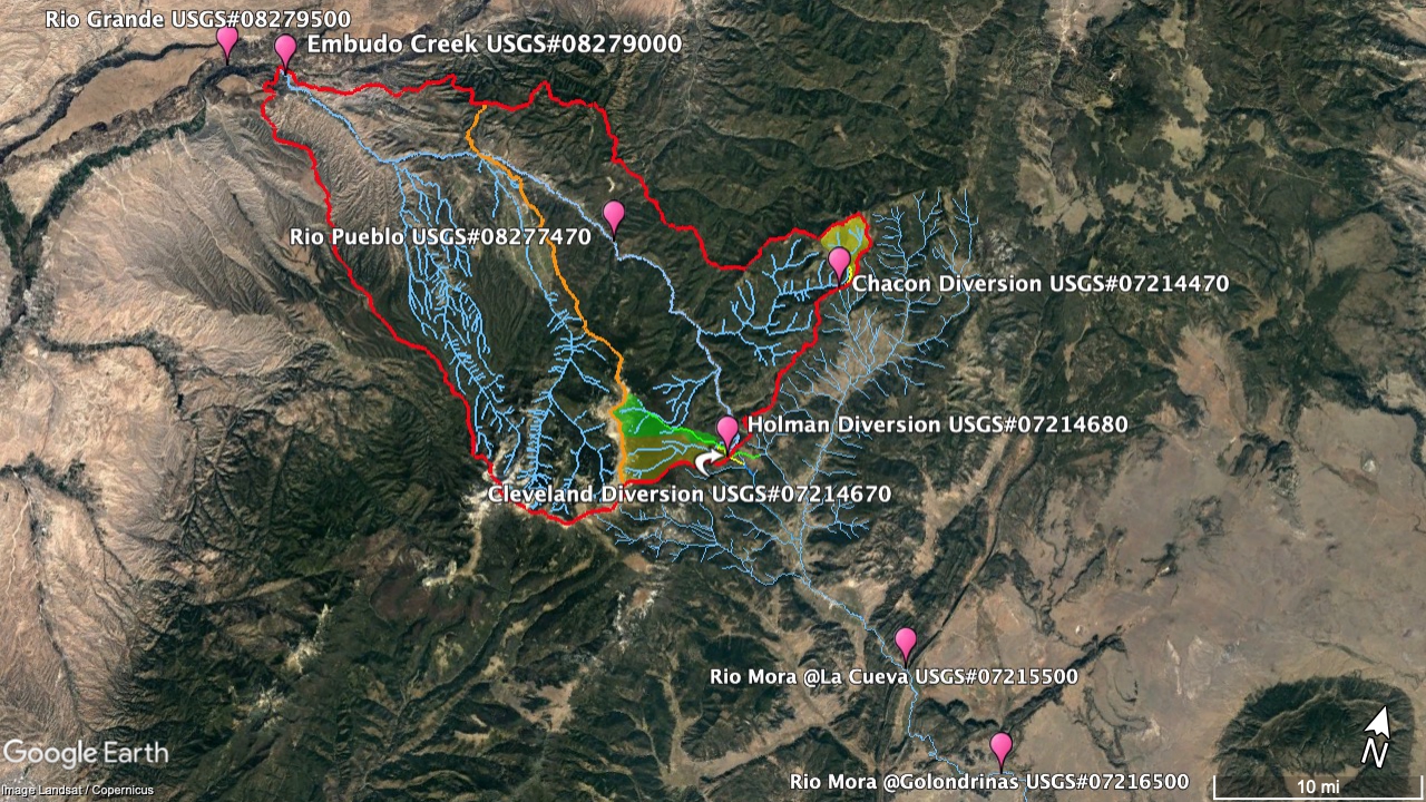
Gages for the Rio Pueblo de Picuris/Rio Embudo watershed:
Embudo Creek (USGS#08279000): Stream Flow
Rio Pueblo de Picuris near Peñasco (USGS#08277470): Stream Flow
Compare: Rio Pueblo (USGS#08277470) and Embudo Creek: Stream Flow
Cleveland Cross-basin Diversion [Canoncito Ditch Near Holman] (USGS#07214670): Stream Flow
Chacon Cross-basin Diversion [Sierra Ditch near Chacon] (USGS#07214470): Stream Flow
Holman Cross-basin Diversion [La Sierra Ditch near Holman] (USGS#07214680): Stream Flow
Gages on the Rio Mora:
Mora River at La Cueva (USGS#07215500): Stream Flow
Mora River near Golondrinas (USGS#07216500): Stream Flow
Gages on the Rio Grande:
Rio Grande after confluence with the Rio Embudo (USGS#08279500): Stream Flow
Rio Chama near Chamita (USGS#08290000): Stream Flow
Rio Grande at Otowi Bridge (USGS#08313000): Stream Flow
Rio Grande below Cochiti Dam (USGS#08317400): Stream Flow
For the individual gage pages, details about each gage (location, etc.) is available by scrolling down to the "Summary of all available data for this site" link.
Map of Selected Gage Locations relative to Rio Pueblo de Picuris Catchment Area: